Research Topics
GNSS Ubiquitous Sensing
Building Facade Ranging using GNSS Interferometric Reflectometry (GNSS-IR)
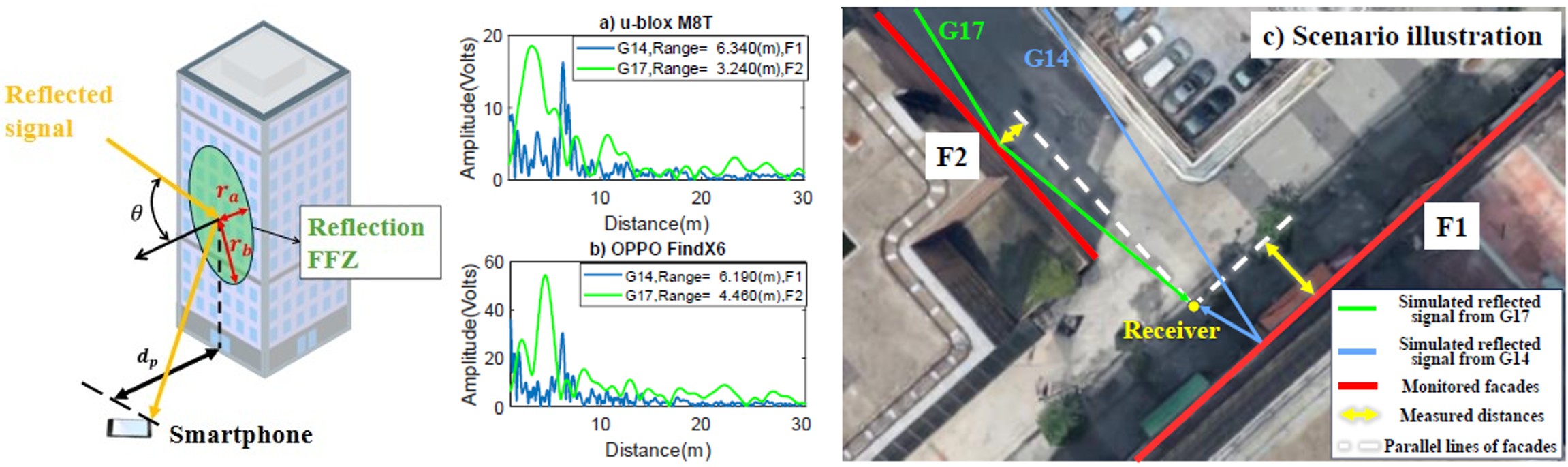
Ubiquitous sensing using RF signals has emerged as a cost-effective way to gather real-time spatial information with existing signals and sensors, though few studies have accurately measured urban building geometry through RF sensing techniques. This study introduces global navigation satellite system interferometric reflectometry (GNSS-IR) as a potential ubiquitous sensing tool in urban areas. With multi-GNSS and effective quality control, the proposed method precisely measured the perpendicular distances to building facades in complex urban areas with only a smartphone. Decimeter-level or even centimeter-level accuracy and a detection range of more than 100 m is achieved in experiments.
Related publications:
M. Ye and G. Zhang, "A Passive Radar for Urban Ubiquitous Sensing: Building Facade Ranging with GNSS-IR," IEEE Journal of Selected Topics in Applied Earth Observations and Remote Sensing, vol. 18, pp. 28590-28603, 2025, DOI: https://doi.org/10.1109/JSTARS.2025.3628466.
M. Ye, G. Zhang, and L. T. Hsu, "Building Model Rectification Using GNSS Reflectometry," IEEE Geoscience and Remote Sensing Letters, vol. 21, pp. 1-5, 03/2024, DOI: https://doi.org/10.1109/LGRS.2024.3373639.
Ground Object Detection using GNSS Reflection Signals
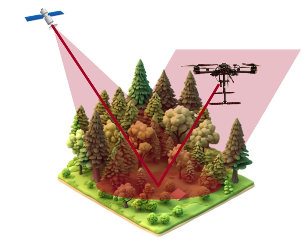
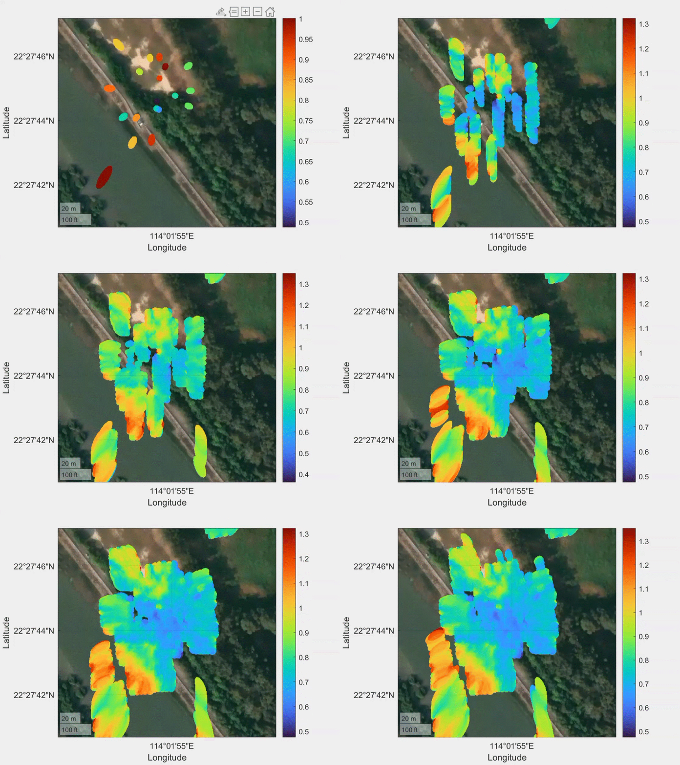
Traditional ground object detection (e.g., vegetation monitoring) relies on manual surveys, costly aerial imaging, or low resolution satellite images. Unmanned Aerial Vehicles (UAVs) offer high flexibility, yet UAV remote sensing systems remain underexplored. This work integrates Global Navigation Satellite System Reflectometry (GNSS) onto an UAV platform to achieve an intelligent and structured remote sensing system for ground object monitoring.